Maps & Spatial Analysis
A collection of my GIS projects, web maps, and urban planning visualizations.
 Remote Sensing
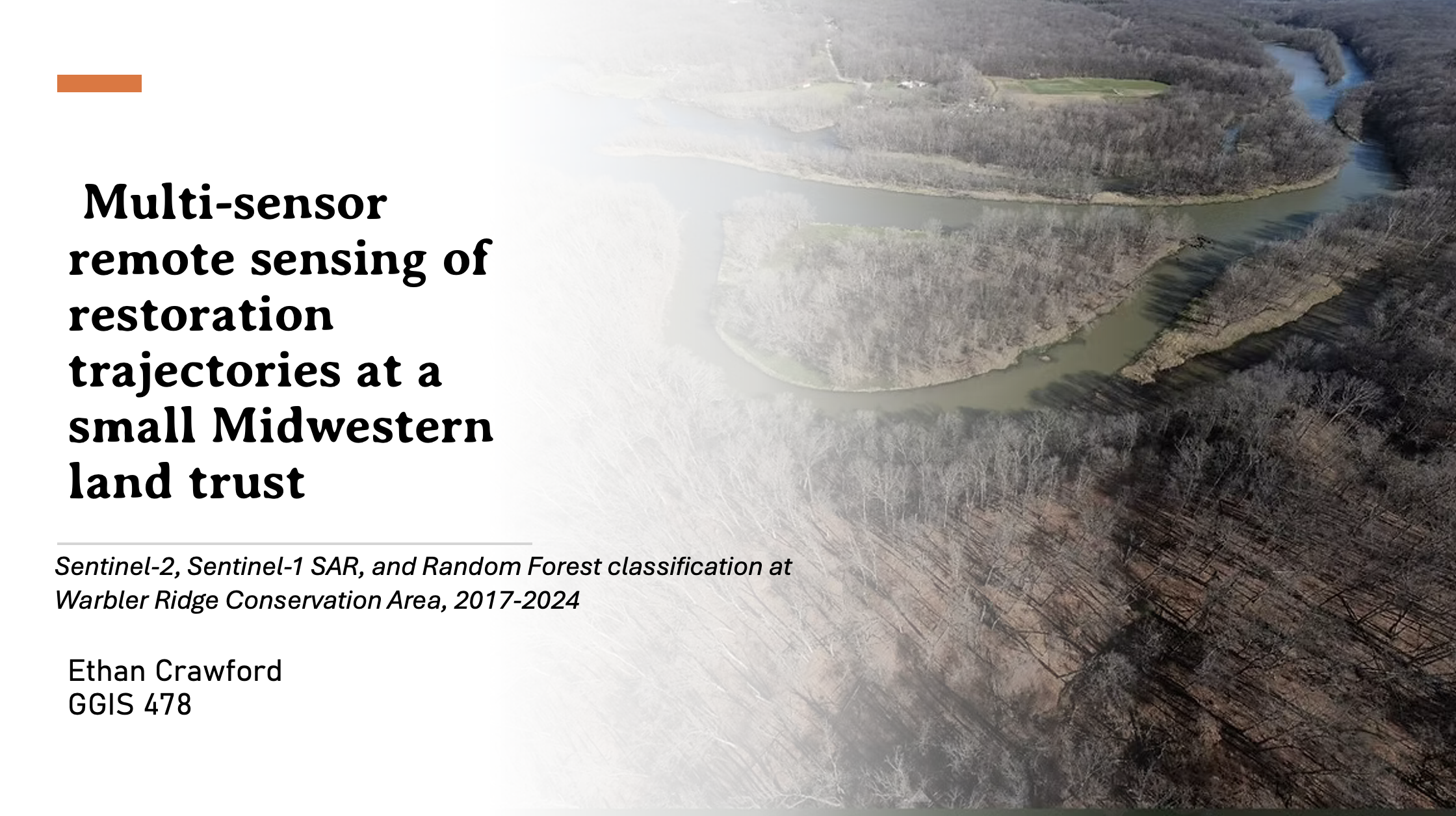
Sentinel-2, Sentinel-1 SAR, and Random Forest classification at Warbler Ridge Conservation Area, 2017-2024
Small land trusts protect a lot of restored land across the Midwest, but they rarely have the resources to monitor restoration outcomes systematically. This project asks whether free satellite imagery and a simple machine learning workflow can fill that gap.
 Cartography
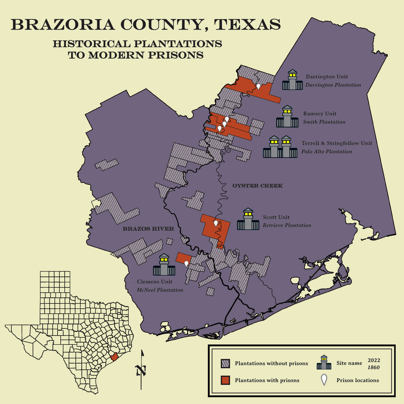
Brazoria County: Historical Plantations to Modern Prisons
A cartographic layout mapping the geographic overlap between 19th-century cotton plantations and modern Texas prison units.
 Remote Sensing
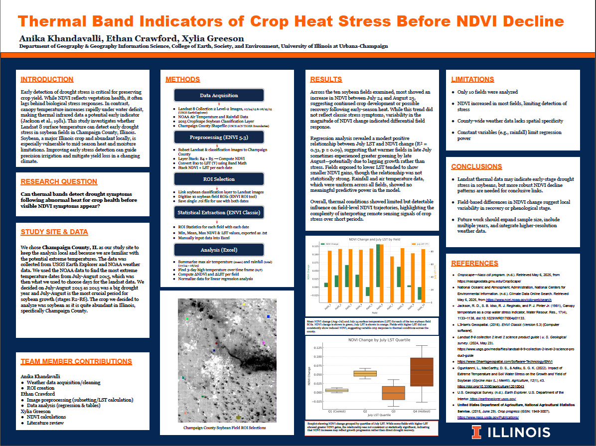
Thermal Band Indicators of Crop Heat Stress Before NDVI Decline
Spatial analysis of thermal imagery to identify pre-NDVI decline crop heat stress.
 GIS Research
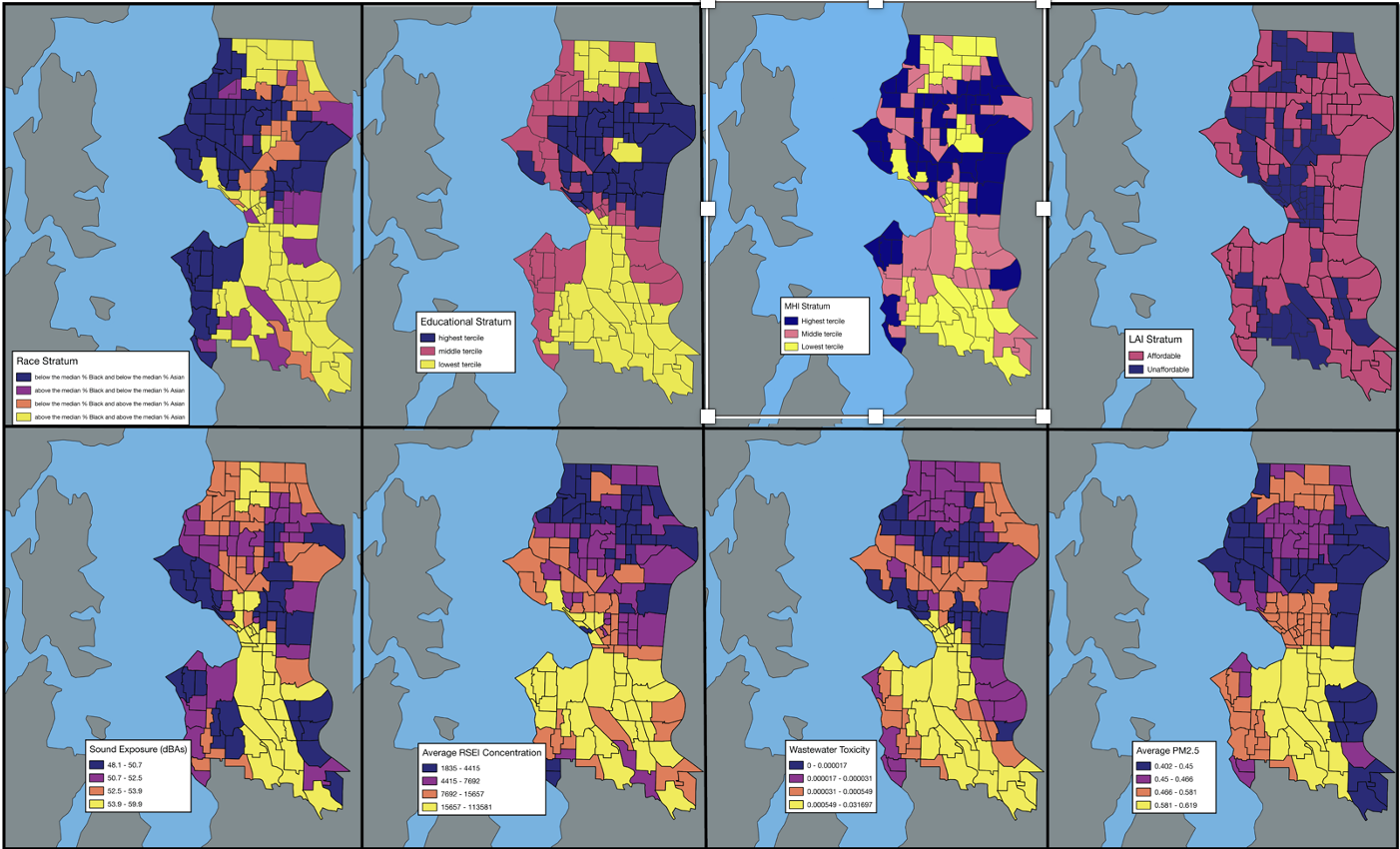
Spatial Analysis of Environmental Health Risks in Seattle
An intersectional GIS analysis combining noise, air toxicity, water toxicity, and PM2.5 data with demographic indicators across Seattle census tracts.
 ArcGIS StoryMap
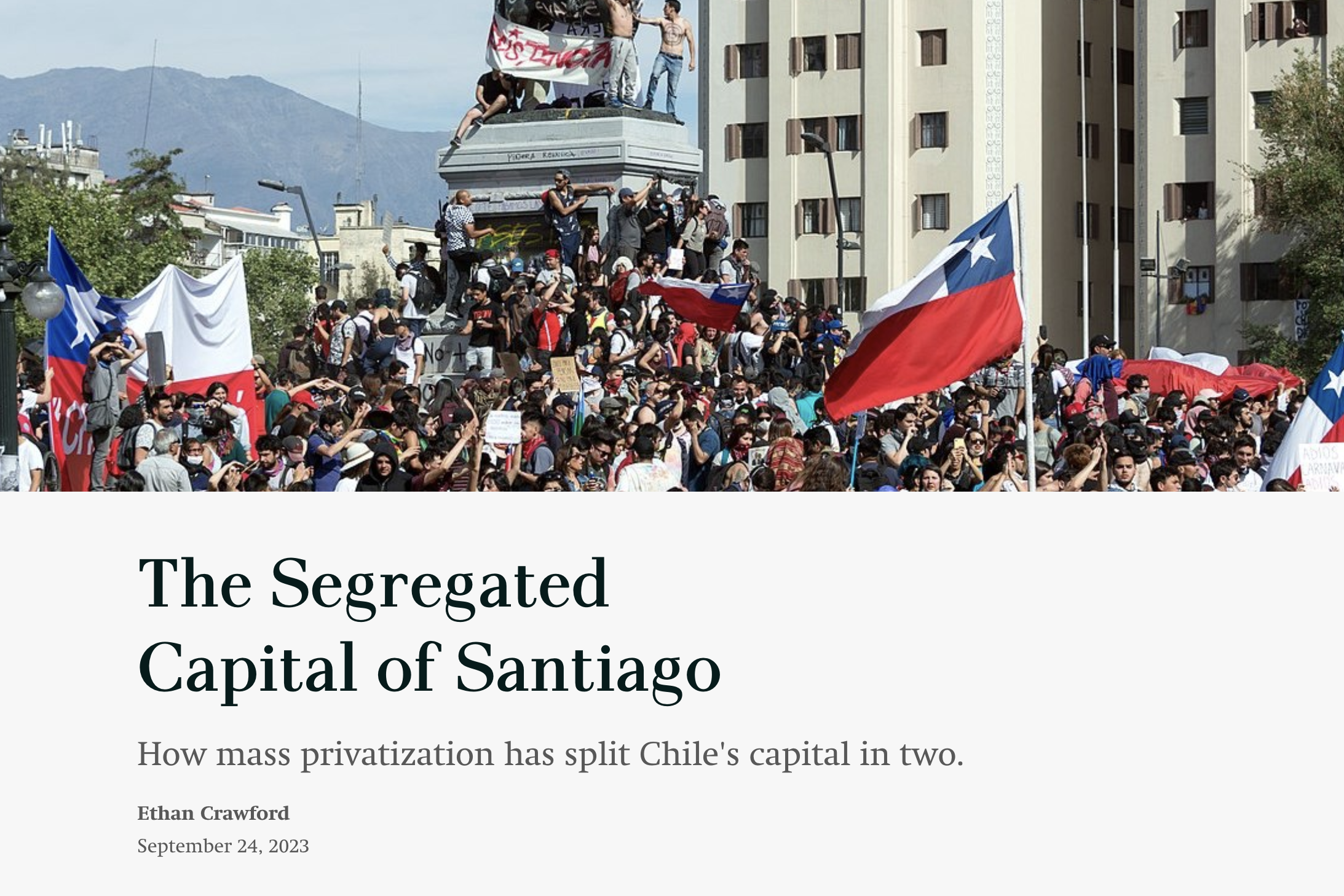
The Segregated Capital of Santiago
An interactive narrative exploring spatial division and urban planning in Chile's capital.
 Spatial Analysis
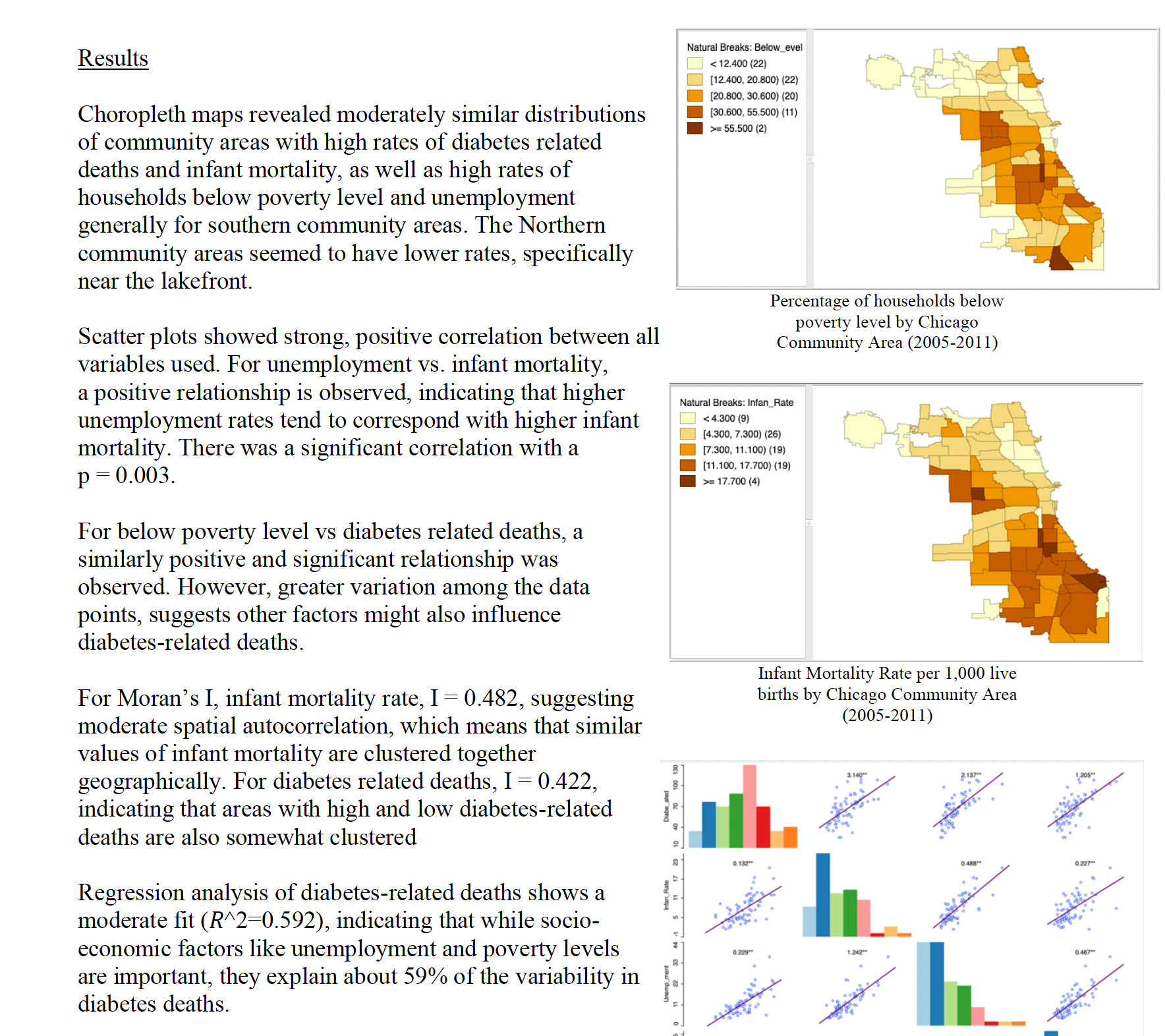
Socio-Economic Factors & Health Outcomes in Chicago
Choropleth mapping and spatial autocorrelation of poverty, unemployment, and health outcomes across Chicago community areas.
 Interactive Leaflet
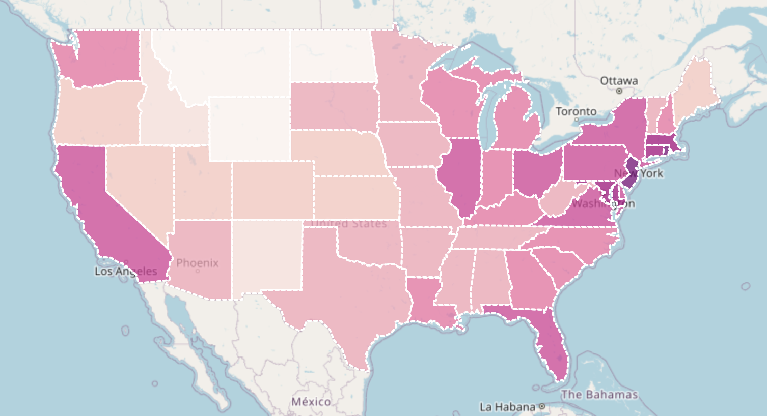
US Population Density
An interactive choropleth map showing population density using US Census Bureau data.